Arkhoti-Tanie Valley, Tanie Lake-Kistani
The length of the route is about 26 kilometers, and it takes two days to complete. The route is harder than average, requiring you to cross rivers more than once, but that makes the experience both unforgettable and rewarding. Make sure you have waterproof boots ready, as you will definitely need them.
It’s recommended to undertake this tour together with experienced, certified guide.
Day One: Akhieli Village to Tanie River
The route starts in the village of Akhieli in the Arkhoti Valley, 1,800 meters above sea level. From there, you follow the valley for three kilometers, until you come to the village of Amgha, which is 1,720 meters above sea level. Amgha is the last village in Arkhoti Valley, after which the nearest populated place is in Ingushetia (Russian Federation), 18 to 20 kilometers away.
Keep walking after the village for around 1.5 kilometers and enter the Assa River Valley. The path will gradually narrow, leading to a canyon, where you have to cross the river and follow its right bank.
Three kilometers later, a tributary will join the Assa River from the right. This is the Taniestskali River, which is fairly deep, and has to be crossed carefully in certain places.
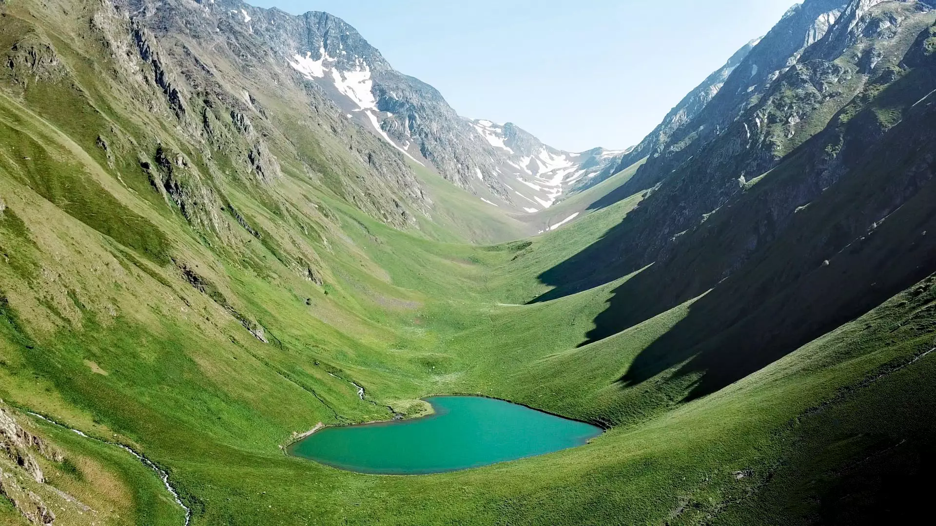
After another 12 kilometers, you will come to a Georgian border guard station. You must register there, because of the proximity to the border with Russia (Ingushetia). Thereafter, you can set up camp around the area or continue on towards Tanie Lake, which is another six kilometers.
There are some amazing places to camp near the beautiful, crystal-clear Tanie Lake, shaped like a heart. The lake is at 2,232 meters, and you can cool down at the lake as well if the water isn’t too cold for you.
Day Two: Tanie Lake to Kistani
From Tanie Lake you follow the valley up to Tanie Pass at 3,040 metres, where you will find yourself at a sort of interchange. From here, you should take the path downwards toward the village of Ukankhadu, but you don’t go all the way down to the village, instead, in about 1.5 kilometers, turn east onto a slope, and follow the slope until you cross onto the ridge. After following the ridge for one kilometer, you will arrive at an intersection of ridges. Take the path towards the east and follow the ridge on your left.
After three kilometers, you will again arrive at an intersection of ridges and, once again, you should take the path to the left. From the ridge, you will see Kistani Fortresses. Keep going for two kilometers, taking the ridge down into the valley, to the village of Kistani, passing to the right of Kistani Fortresses, and coming to the side of a main road.
Kistan village is built at an altitude of 2080 meters above sea level. At one time there used to be about 30 house-fortresses, which served both defensive and residential functions. Currently, only a few of them have survived, although together with the mountains rising up into the sky behind them, make for an exceptional sight.
Cookie Policy