Climbing Mountain Shkhara - a classic route
Peak Characteristics
The highest peak of Georgia, Mount Shkhara is located in Mestia Municipality, on the border between Georgia and Kabardino-Balkaria (Russin Federation). With a height of 5,203 meters, Shkhara is the third-highest summit of the Greater Caucasus Mountains, after Dykh-Tau and Elbrus. To the north of the mountain, sits the Bezengi Glacier, while to the south lies the glacier of Shkhara.
Without any routes of medium difficulty, Shkhara is one of the most difficult summits in Georgia Europe, with all its routes being rated as 5A or 6A.
Along the route, you will encounter scree, crevasses, snow covers, steep rocks, narrow passages, sharp ridges and steep slopes.
Day One
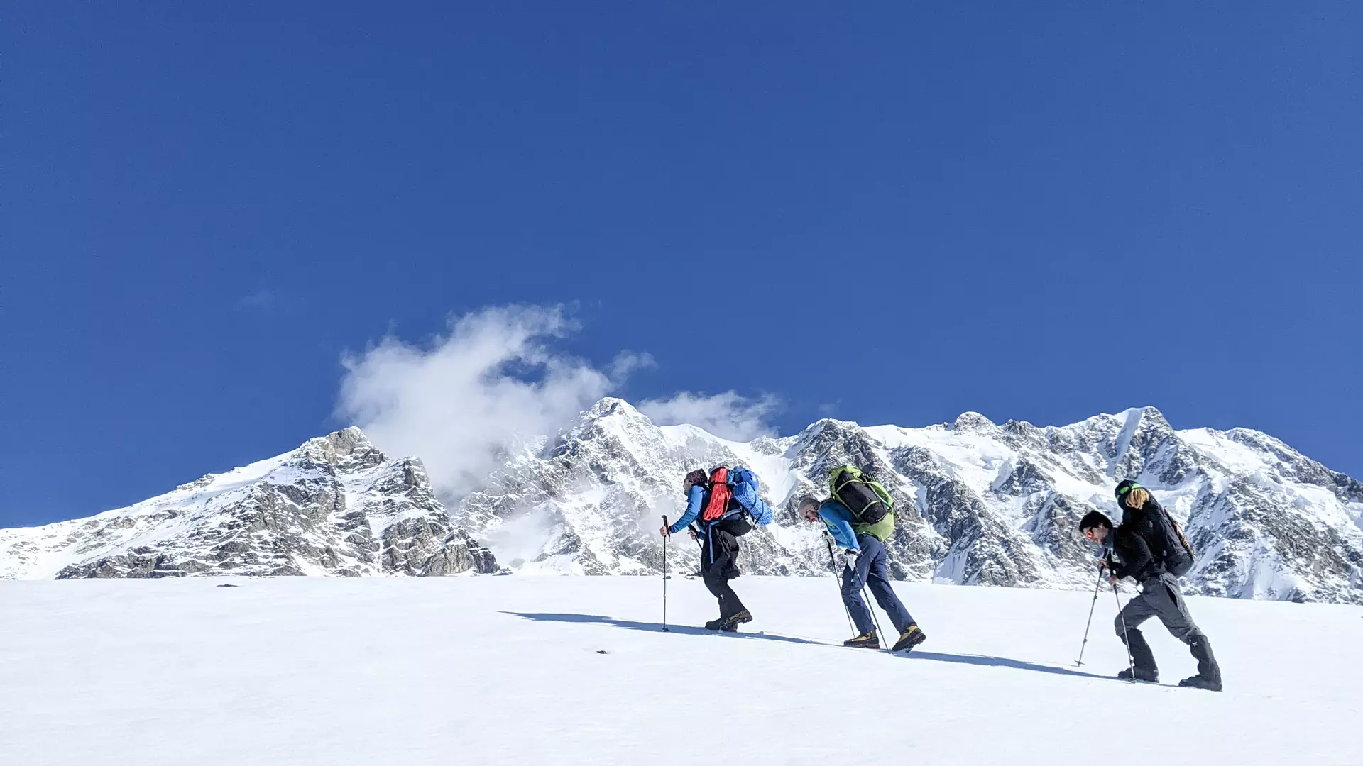
The route starts in the Ushguli community and begins with an 8-kilometer drive by an off-road vehicle from Ushguli to the Shikhara Glacier. The road ends at an altitude of 2,359 meters above sea level. From here, through the glacier, you will reach the first camp, which is located in the rocky massif at an altitude of 3500 meters. The vertical ascent is 1141 meters.
To reach the second camp, you need to cover five ropes.
Day Two
From the first camp, you proceed to the second camp, which is 4300 meters above sea level. The vertical climb is 800 meters. You cross the route tied to a short rope.
Day Three
The third camp is located at 4800 meters above sea level. The vertical climb is 500 meters. The section is difficult as you need to overcome icy and rocky terrain. The time required is approximately 6-7 hours.
Day Four
From the third camp, you will leave for the summit at dawn. After crossing 403 verticals, you will arrive at the peak of Shkhara. After a short wait at the summit, you descend via a different route, because the route up becomes dangerous during the day due to melting snow and rock falls. You descend back down the southern ridge to the Namkvami glacier and camp on the plateau. The time required is approximately 7-8 hours.
Day Five
You descend from the plateau to the southern ridge, to Namkvami glacier and return to the car road by crossing the glacier.
In case of bad weather, you will need to consider two additional backup days.
Additional Information
It is recommended to climb Shkhara Mountain between mid-July and the end of September.
The starting point of the route is 55 km from the center of Mestia. An off-road vehicle is required to reach it, which can be rented at Mestia bus station.
Cookie Policy