Kayaking on the Chirukhi River
Difficulty
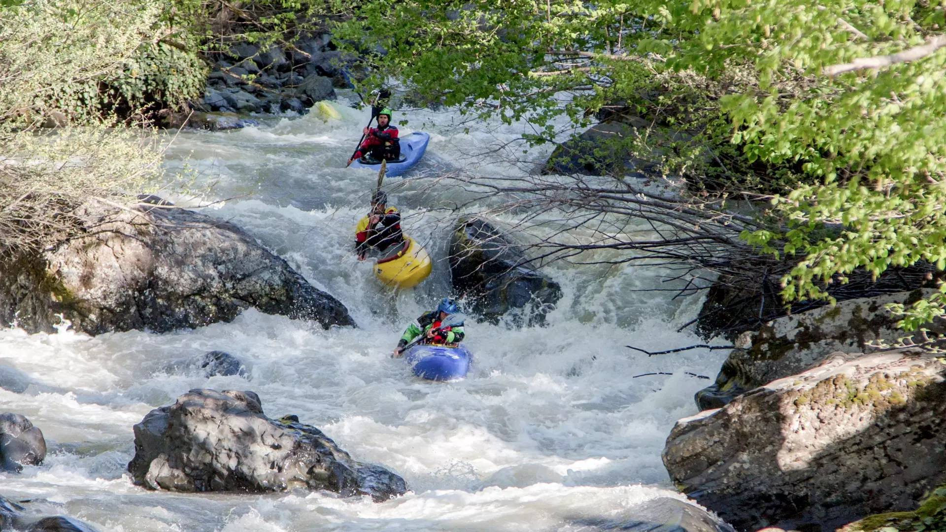
The river section has a difficulty rating ranging between 4 and 5.
Location
The Chirukhi Valley, through which the route passes, is located in the mountainous part of Ajara Region. The highest point of the route is 2,145 m above sea level.
River
The Chirukhi River originates at an altitude of 2,220 meters on the Shavsheti Ridge's northern slopes. The river is 32 kilometers long and is fed by snow, rain, and underground waters. It converges with the Ajaristskali River.
Route
The route starts in the village of Goginauri, at 473 m above sea level, and ends in Shuakhevi, at 393 m above sea level.
The length of the section is 10 km, with a drop in elevation of 80 m, and the difficulty of the route is classified between 4 and 5 (extremely difficult, long and difficult rapids, steep drops, large stones).
Season
Suitable months for kayaking are March to May, and October to November.
How to get to the starting point
Chirukhi Gorge can be reached only by off-road vehicle. The starting place, the village of Goginauri, is 15 km away from Shuakhevi.
Safety
Prior experience in kayaking is necessary to kayak down this route.
It is advised to either descend the river with a local kayaker or at least get information from such a person before your trip. To book a tour, contact a local company in advance.
The minimum age for kayaking is 18 years.
Cookie Policy