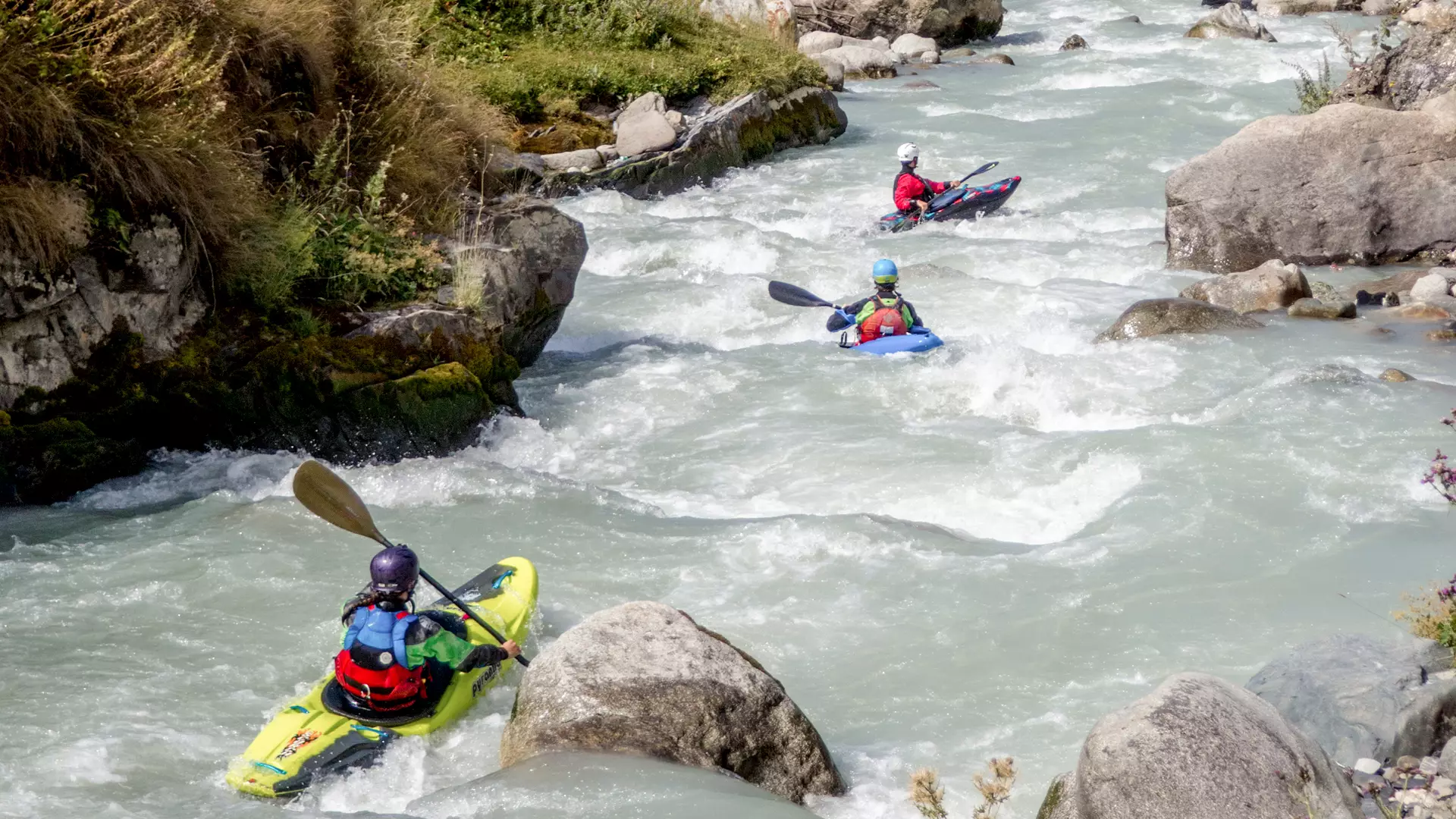
Kayaking on the Enguri in Zemo Svaneti
Location
Svaneti is a stunning mountainous region in northwest Georgia(Caucasus), with peaks covered in snow and ice year-round, the bountiful Enguri and Tskhenistskali rivers, and difficult passes.
River
The 213-kilometer Enguri River starts from the glacier of Mt Shkhara (5203 m), 2,614 meters above sea level. It is fed by glacial snow, and underground waters joined by several other rivers, and finally reachs the Black Sea near the resort Anaklia.
Route
The first section of the route starts in the village of Chazhashi, in Ushguli Community, 2,160 meters above sea level, and ends at the village of Iprari, 1,800 meters above sea level.
The length of the second section is 9 kilometers, with a drop in elevation of 360 meters and a difficulty rating ranging between 4 and 5 (extremely difficult, long and difficult rapids, steep falls, large rocks).
The second section starts in the village of Iprari, at 1,800 meters above sea level, and ends at Nakipari Village, at 1,514 meters. The length of the second section is 12 kilometers, with a drop in elevation of 286 meters and a difficulty rating ranging between 3 and 4 (intermediate difficulty, high and irregular waves, cliffs, whirlpools, transparent but narrow exits). The whole section follows a main road.
The third section starts in the village of Nakipari at 1,514 meters and ends at the Kvanchianari Village in the Latali Community, 1,199 meters above sea level.
The section is 20 kilometers long, with a drop in elevation of 315 meters. The majority of the section does not go along any road.
The fourth section starts at the village of Kvanchianari (Latali Community), at 1,199 meters, and ends at the confluence to the Nakra River, 900 meters above sea level.
The section is 24 kilometers long, with a drop in elevation of 299 meters.
The fifth section starts at the village of Nodashi, 930 meters above sea level, and ends at the village of Jorkvali, 743 meters above sea level. The section is 20 kilometers long with a drop in elevation of 187meters.
The third, fourth, and fifth sections rank at a 5-5+ difficulty level (extremely difficult, long drops with small distances in between. The current is fast and strong, with an extremely steep gradient, requiring a high level of expertise).
The sixth section starts in the village of Khaishi, at 557 meters above sea level, and ends in Leburtskhila Village, at the beginning of the Enguri Reservoir, at 530 meters.
The section is 10 kilometers long with a drop in elevation of only 27 meters. The sixth section ranks at a 3-3+ difficulty level (somewhat difficult, with multiple, high, irregular waves, cliffs, and whirlpools, with transparent, but narrow, exits).
Season
The best months for kayaking on all sections of the Enguri are April to May and September to October or the beginning of November.
How to Get to the Starting Point
You can use any type of vehicle to reach the starting point of the route, at the village of Chazhashi (Ushguli Community).
Safety
For kayaking on this route, you will need high expertise!
To enjoy kayaking safely, you will first have to go through special training with a highly-qualified instructor on a river or any dammed water or lake. Professional kayakers will evaluate your skills and advise you on a suitable route, where you can paddle down safely under their supervision.
We strongly advised you to kayak with a local kayaker or at least get information from such a person before your trip. To book a tour, contact a local company in advance.
The minimum age for kayaking is 18 years.
Cookie Policy