Kayaking on the Tskhenistskali
Difficulty
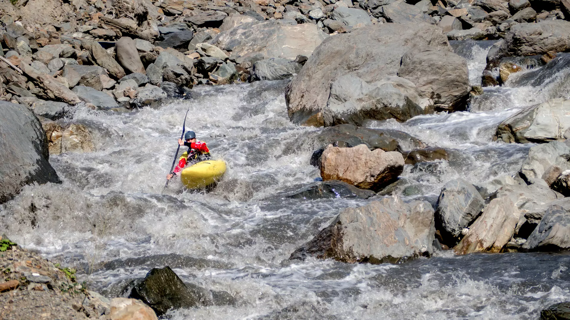
The difficulty rating of the sections of the Tskhenistskali River range between 3 and 5.
Location
The village of Sakdari, where the route starts, is located in Lentekhi municipality, on the right bank of the Tskhenistskali River.
River
The Tskhenistskali River has its source on the southern slopes of the Svaneti Caucasus Mountains, near the peak of Pasismta, 2,710 meters above sea level. The length of the river is 176 kilometers, and it is fed by snow, rain, glacier, and underground waters. It joins the Rioni River near the village of Sajavakho in the Kolkhetian Lowlands.
The Route
The first section starts in Sakdari, 1,040 meters above sea level, and ends in the town of Lentekhi, 770 meters above sea level.
The length of the first section is 11 kilometers, with a drop in elevation of 270 meters, and a difficulty rating ranging between 4 and 5 (extremely hard, long and difficult rapids, steep drops, large rocks).
The second section starts in Lentekhi, 770 meters above sea level, and ends in the town of Tsageri, 590 meters above sea level. The length of the second section is 12 kilometers, with a drop in elevation of 180 meters, and a difficulty rating ranging between 3 and 3+ (intermediate difficulty, high and irregular waves, cliffs and whirlpools, transparent but narrow exits).
The third section starts in Zubi Canyon in Tsageri municipality, and ends in the village of Mukhura, 360 meters above sea level.
The length of the third section is eight kilometers, with a drop in elevation of 45 meters, and a difficulty rating of 4 (difficult, high and irregular waves, cliffs and whirlpools, transparent but narrow exits). This section is dependent on water from the nearby reservoir, and it is recommended that you view the canyon before going through the third section.
The fourth section starts in the village of Makhura, 360 meters above sea level, and ends in the village of Khidi, 190 meters above sea level.
The length of the fourth section is 24 kilometers, with a drop in elevation of 170 meters, and a difficulty rating ranging between 3 and 4 (difficult, high and irregular waves, cliffs and whirlpools, transparent but narrow exits).
Season
You can go kayaking on the first and second sections in April, May, and October, and on the third section from March to October.
In addition, you can go on the fourth section in late March and early October.
How to Get to the Starting Point
It is 12 kilometers from the village of Sakdari to Lentekhi, and the starting point can be reached using an SUV.
Safety
You must be an experienced kayaker in order to kayak down this river.
In addition, it is recommended that you descend the river with a local kayaker or at least get necessary information from a local kayaker. Contact a local company in advance to book a tour.
The minimum age for kayaking is 18.
Cookie Policy