Omalo-Atsunta-Shatili
Omalo and Shatil can be connected by several routes which differ in their type and duration. Here you will find a combination of 2 popular versions.
Day One: Omalo - Dartlo
The route starts in Tusheti Region, from the village of Omalo. In the beginning, the trail goes towards Ghele Pass, through the forest, and after reaching the pass, it starts to downhill to the Alazani valley and arrives at Dartlo, an iconic and probably the most popular village of Tusheti, known for its authentic architecture and abundance of Tushetian type of towers and houses.
If you will start the day near Keselo Fortress, the distance to be covered between Omalo to Dartlo will be about 11 kilometers. The route mainly follows the dirt road.
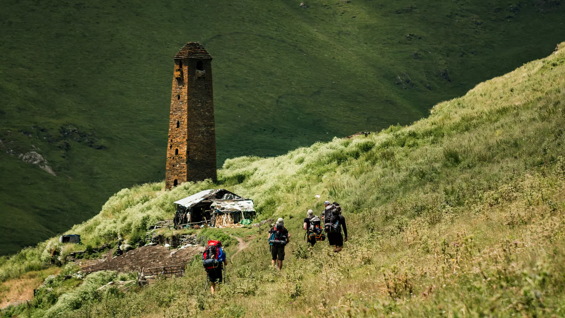
Day Two: Dartlo - Girevi
From Dartlo, the route follows a vertical serpentine going up to the village of Kvavlo, located directly above it and offering wonderful views of the whole surroundings. From Kvavlo the route continues on a relatively levelled footpath and arrives at the village of Dano, from where the path descends and joins the dirt road again. Then you will pass through Chesho and Farsma villages, and finally, arrive in Girevi village, where you can spend the night in a family hotel or in a designated camping area.
Note, that in Girevi it is mandatory to make registration at the border guard station. The procedure is needed because the area is close to the Georgia-Russia border, Chechnya-Ingushetia section. The registration process takes approximately one hour.
On this day of the hike, you will cover about 17 kilometers.
The route mostly follows the dirt road.
Day Three: Girevi - Kvakhidi
From Girevi, you will follow the Kvakhidistskali valley, pass through the abandoned village of Chontio and arrive at Kvakhidi campsite, which is the most convenient place to set up the tent. Here you will find a beautiful valley with a diverse landscape and natural sites.
The trail is 15 km long and belongs to the moderate difficulty category.
Day Four: Kvakhidi - Khidotani
On this day of the hike, you will move in the direction of Atsunta Pass. The trail is 17 kilometers long and is quite difficult to overcome.
In the beginning, you follow the Kvakhidistskali valley, and soon after will come across a river which you should ford carefully. Then, you start the way up towards the pass, the trail gradually becomes difficult, and goes up to the top of Atsunta Pass, at 3520 meters above sea level, offering breathtaking views of two mountainous regions of the country, Tusheti and Khevsureti. From the pass, you can start your way down in direction of Khevsureti and after covering about 2,5 kilmerets you will reach Atsunti campsite. From here you will need to hike downhill for 6 more kilometers and you will arrive at the last destination of this day - Khidotani campsite. Here is also a post of the border guards, where you should show the permit taken in Girevi.
Day Five: Khidotani - Shatili
On the final day of the trip, you will cover about 18 kilometers. From Khidotani, the route goes down to Khonistskali valley, where you will pass through the village of Khonischala and soon reach the fortress-village of Mutso, an outstanding sight of Khevsureti, built on a steep slope. From Mutso, the route continues on a main road and after passing around 11 kilometers, you will arrive at Shatili, a unique complex which leaves an unforgettable impression on its visitors.
You can find a number of family hotels and nice camping spots in Shatili.
The distance between Mutso to Shatila can be covered by a car.
The second version of the Omalo - Shatili route is shorter and requires 4 days. By this version, the route from Omalo directly arrives at the village of Girevi on the first day of the trip and from there it follows the same itinerary as described above.
The first day of the second version is as follows:
Day One: Omalo - Girevi
The route starts in Tusheti Region, from the village of Omalo. In the beginning, the trail goes towards Ghele Pass, through the forest, and after reaching the pass, the route continues on Makratela Ridge in the direction of Nakaicho Pass. From the pass, you will go downhill and first arrive in the village of Parsma and finally will reach Girevi village, where you can spend the night in a family hotel or in a designated camping area.
Note, that in Girevi it is mandatory to make registration at the border guard station. The procedure is needed because the area is close to the Georgia-Russia border, Chechnya-Ingushetia section. The registration process takes approximately one hour.
If you will start the journey at Keselo Fortress, the distance to be covered between Omalo to Girevi will be about 26 kilometers, which requires good physical fitness to be covered in one day.
Cookie Policy