Ushguli- Mami
Ushguli-Mami Route Details
The most difficult aspects of this route are that there are no places to camp and it takes 10-12 hours to cover the entire route.
Taking note of this difficulty, a great adventure and memorable moments are in ready supply for hiking lovers. During the trip, you can enjoy staggering views and see the entire route from above.
Ushguli Community
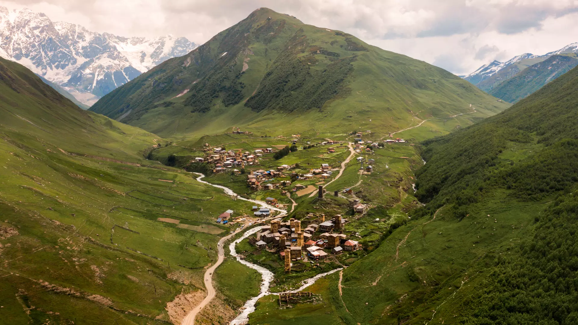
The route starts in the Ushguli community, in the village of Chazhashi, from the marking pole at the bridge (2,100 meters). Chazhashi in Svan language means horse stable. Meanwhile, according to legend, when Queen Tamar used to travel to Svaneti, she left her horses at this village. Moreover, Chazhashi has been declared a museum village and is recognized by UNESCO as a world heritage site.
The hiking route goes by an ethnographic museum, along the Enguri River, and downwards to the village of Murkmeli (2,040 meters). In Svan language, Murkmeli means “village of towers,” and indeed this village is a veritable kingdom of the most beautiful Svan towers. Centuries ago, here up to 80 combat towers were found, but only 10 have survived.
Latpari Mountain Pass
From this village, the road takes you up to Latpari Pass, which is located at the source of two rivers: Lamushuristskali and Valeshi. The mountain pass is covered with alpine and sub-alpine meadows, and connects Zemo (upper) and Kvelo (lower) parts of Svaneti. At the highest point of the mountain pass, you are 3,050 meters above sea level, with inexplicably glorious vistas of Svaneti in front of you.
Mami Village
After taking a break and enjoying the sublime views, continue your trip downwards along a rocky path. After crossing several springs, you enter forests and in the valley stand two summer huts for shepherds. From the forest, you take the path toward the village of Mami - the distance from the mountain pass to the village can be completed by foot in one hour. The last stop is the village of Mami, which is 1,100 meters above sea level.
Cookie Policy